Old Wayside Cross by Hutton Lane, Guisborough parish
Introduction
The photograph on this page of Old Wayside Cross by Hutton Lane, Guisborough parish by Alan Rosevear as part of the Geograph project.
The Geograph project started in 2005 with the aim of publishing, organising and preserving representative images for every square kilometre of Great Britain, Ireland and the Isle of Man.

There are currently over 7.5m images from over 14,400 individuals and you can help contribute to the project by visiting https://www.geograph.org.uk
Old Wayside Cross by Hutton Lane, Guisborough parish
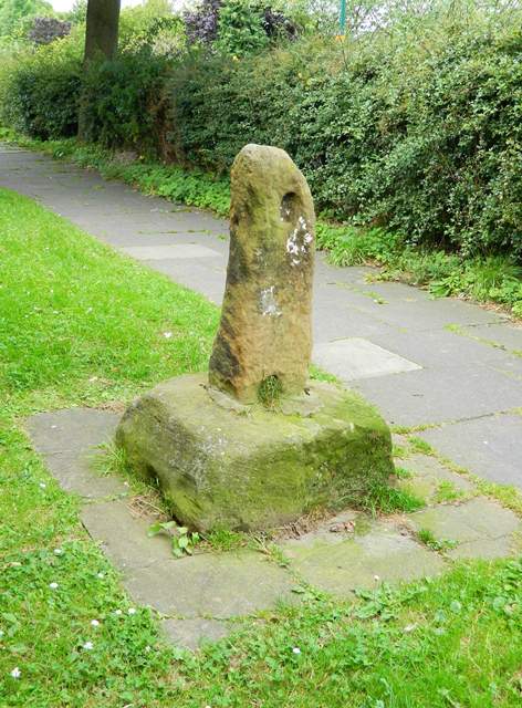
Image: © Alan Rosevear Taken: 19 Aug 2012
Ruther Cross, old shaft and base, by the UC road, in parish of Guisborough (Redcar and Cleveland District), Hutton Lane, at the edge of the Dorset Road, gable end of No.5 Kintyre Walk (where the old Ruthergate track crossed Hutton Lane), on mown grass between end of house and path by a hedge bounding the main road. Grade II listed. List Entry Number: 1159569 https://historicengland.org.uk/listing/the-list/list-entry/1159569 Surveyed Milestone Society National ID: CCRC_GUI03
Images are licensed for reuse under creativecommons.org/licenses/by-sa/2.0
Image Location
Latitude
54.526553
Longitude
-1.067682