Old Milestone by the A28, Ashford Road, High Halden
Introduction
The photograph on this page of Old Milestone by the A28, Ashford Road, High Halden by JR Dowding as part of the Geograph project.
The Geograph project started in 2005 with the aim of publishing, organising and preserving representative images for every square kilometre of Great Britain, Ireland and the Isle of Man.

There are currently over 7.5m images from over 14,400 individuals and you can help contribute to the project by visiting https://www.geograph.org.uk
Old Milestone by the A28, Ashford Road, High Halden
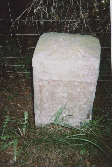
Image: © JR Dowding Taken: 27 Apr 2002
Metal plate attached to stone post by the A28, in parish of HIGH HALDEN (ASHFORD District), village of High Halden, at back of verge in front of wire fence, on South side of road. Tenterden marker, erected by the Bethersden turnpike trust in the 19th century. Inscription reads:- TENTERDEN 3 ASHFORD 9 Carved benchmark and rivet on top. Kent HER. HER Number: TQ 83 NE 201 https://www.heritagegateway.org.uk/Gateway/Results_Single.aspx?uid=MKE78197&resourceID=1005 Milestone Society National ID: KE_TTAF03
Images are licensed for reuse under creativecommons.org/licenses/by-sa/2.0
Image Location
Latitude
51.10359
Longitude
0.704414