Direction Sign - Signpost at the east end of Charity Lane, Mells parish
Introduction
The photograph on this page of Direction Sign - Signpost at the east end of Charity Lane, Mells parish by Milestone Society as part of the Geograph project.
The Geograph project started in 2005 with the aim of publishing, organising and preserving representative images for every square kilometre of Great Britain, Ireland and the Isle of Man.

There are currently over 7.5m images from over 14,400 individuals and you can help contribute to the project by visiting https://www.geograph.org.uk
Direction Sign - Signpost at the east end of Charity Lane, Mells parish
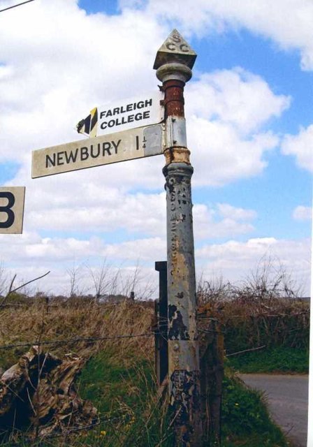
Image: © Milestone Society Taken: Unknown
Pyramid finial - 1 arm; Somerset SCC pyramid by the UC road, in parish of Mells (Mendip District), on the southwest side of the T junction at the east end of Charity Lane. Not visible on Google Earth in March 2019 surveyed Milestone Society National ID: SO_ST7050B
Images are licensed for reuse under creativecommons.org/licenses/by-sa/2.0
Image Location


Leaflet Map data © OpenStreetMap
Latitude
51.250624
Longitude
-2.418618