Old Direction Sign - Signpost by the A242, Wray Common
Introduction
The photograph on this page of Old Direction Sign - Signpost by the A242, Wray Common by John V Nicholls as part of the Geograph project.
The Geograph project started in 2005 with the aim of publishing, organising and preserving representative images for every square kilometre of Great Britain, Ireland and the Isle of Man.

There are currently over 7.5m images from over 14,400 individuals and you can help contribute to the project by visiting https://www.geograph.org.uk
Old Direction Sign - Signpost by the A242, Wray Common
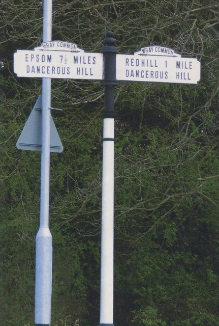
Image: © John V Nicholls Taken: Unknown
Pawn finial - 4 arms; Surrey arch name arms by the A242, in parish of Reigate (Reigate And Banstead District), Wray Common, Gatton Park Road junction with Batts Hill, Croydon Road and Wray Lane, on verge by roundabout (arm was broken in 2009 - restored back to 4 arms by 2012). Surveyed Milestone Society National ID: SY_TQ2651
Images are licensed for reuse under creativecommons.org/licenses/by-sa/2.0
Image Location
Latitude
51.245589
Longitude
-0.186877