Former barn at Mill House Farm, Railes Lane, Luddenden
Introduction
The photograph on this page of Former barn at Mill House Farm, Railes Lane, Luddenden by Stephen Craven as part of the Geograph project.
The Geograph project started in 2005 with the aim of publishing, organising and preserving representative images for every square kilometre of Great Britain, Ireland and the Isle of Man.

There are currently over 7.5m images from over 14,400 individuals and you can help contribute to the project by visiting https://www.geograph.org.uk
Former barn at Mill House Farm, Railes Lane, Luddenden
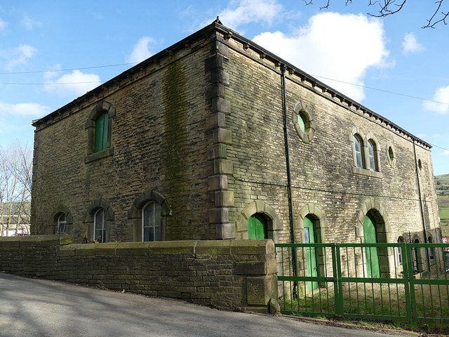
Image: © Stephen Craven Taken: 16 Feb 2019
This late 19th century building, along with the "pigsties, boundary wall to West of barn, yard, trough, ramp and flanking walls", was listed grade II in 2016 (list entry 1437098) as part of a planned and architect-designed set of farm buildings. According to Historic England, this building was in farm use, at various times as a barn, abattoir and dairy, until 2016.
Images are licensed for reuse under creativecommons.org/licenses/by-sa/2.0
Image Location


Leaflet Map data © OpenStreetMap
Latitude
53.734697
Longitude
-1.942662