Marsh Wall, July 1989 (1)
Introduction
The photograph on this page of Marsh Wall, July 1989 (1) by Stefan Czapski as part of the Geograph project.
The Geograph project started in 2005 with the aim of publishing, organising and preserving representative images for every square kilometre of Great Britain, Ireland and the Isle of Man.

There are currently over 7.5m images from over 14,400 individuals and you can help contribute to the project by visiting https://www.geograph.org.uk
Marsh Wall, July 1989 (1)
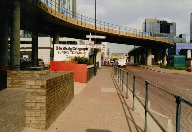
Image: © Stefan Czapski Taken: 16 Jul 1989
View eastwards at the junction with Millharbour. A sign points the way to the offices of the London Docklands Development Corporation - a pretty hectic place at the time. The Telegraph group were early adopters, and early arrivals 'on the island'. The photo was taken on a Sunday afternoon - but I have to say that even on weekdays there was the sense that the transformation of the area had just begun. South Quay DLR station is just behind the camera, to the left.
Images are licensed for reuse under creativecommons.org/licenses/by-sa/2.0
Image Location
Latitude
51.500294
Longitude
-0.018284