Old Boundary Marker on Rush Common, Brixton Hill
Introduction
The photograph on this page of Old Boundary Marker on Rush Common, Brixton Hill by Milestone Society as part of the Geograph project.
The Geograph project started in 2005 with the aim of publishing, organising and preserving representative images for every square kilometre of Great Britain, Ireland and the Isle of Man.

There are currently over 7.5m images from over 14,400 individuals and you can help contribute to the project by visiting https://www.geograph.org.uk
Old Boundary Marker on Rush Common, Brixton Hill
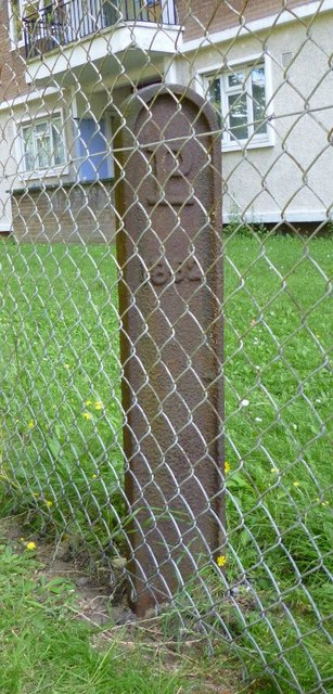
Image: © Milestone Society Taken: Unknown
Parish Boundary Marker in parish of Brixton (Lambeth District), Rush Common SW2, South end of common against wire fence of Roupell Park Estate. Inscription reads:- LP 1862 Surveyed Milestone Society National ID: SY_LAMB03pb
Images are licensed for reuse under creativecommons.org/licenses/by-sa/2.0
Image Location
Latitude
51.447337
Longitude
-0.123821