Old Direction Sign - Signpost by the B3440, Locking Road, Weston super Mare
Introduction
The photograph on this page of Old Direction Sign - Signpost by the B3440, Locking Road, Weston super Mare by Milestone Society as part of the Geograph project.
The Geograph project started in 2005 with the aim of publishing, organising and preserving representative images for every square kilometre of Great Britain, Ireland and the Isle of Man.

There are currently over 7.5m images from over 14,400 individuals and you can help contribute to the project by visiting https://www.geograph.org.uk
Old Direction Sign - Signpost by the B3440, Locking Road, Weston super Mare
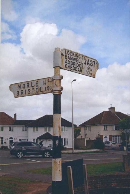
Image: © Milestone Society Taken: 1 Apr 2013
Lost finial - 2 arms; Somerset pointing fingers by the B3440, in parish of Weston super Mare (North Somerset District), Locking Road junction with Locking Moor Road, in front of the Borough Arms PH, on pavement, against low brick wall around pub. See https://www.geograph.org.uk/photo/7627779 for a more recent photo. Surveyed Milestone Society National ID: SO_ST3461
Images are licensed for reuse under creativecommons.org/licenses/by-sa/2.0
Image Location
Latitude
51.350452
Longitude
-2.942901