Dumfries from the air
Introduction
The photograph on this page of Dumfries from the air by Thomas Nugent as part of the Geograph project.
The Geograph project started in 2005 with the aim of publishing, organising and preserving representative images for every square kilometre of Great Britain, Ireland and the Isle of Man.

There are currently over 7.5m images from over 14,400 individuals and you can help contribute to the project by visiting https://www.geograph.org.uk
Dumfries from the air
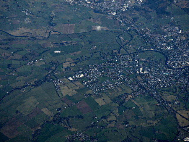
Image: © Thomas Nugent Taken: 11 Feb 2019
Terregles is in the foreground, Cluden Water and the River Nith can be seen converging from the left at the north end of the town. Heathhall is at the top, Dumfries town centre on the right.
Images are licensed for reuse under creativecommons.org/licenses/by-sa/2.0
Image Location
Latitude
55.071499
Longitude
-3.669416