Mill dam at Manor Farm
Introduction
The photograph on this page of Mill dam at Manor Farm by Gordon Hatton as part of the Geograph project.
The Geograph project started in 2005 with the aim of publishing, organising and preserving representative images for every square kilometre of Great Britain, Ireland and the Isle of Man.

There are currently over 7.5m images from over 14,400 individuals and you can help contribute to the project by visiting https://www.geograph.org.uk
Mill dam at Manor Farm
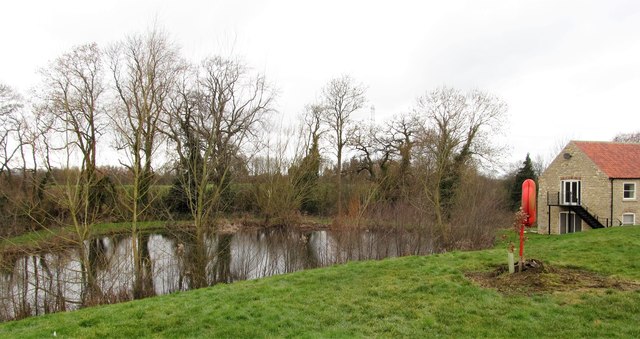
Image: © Gordon Hatton Taken: 18 Feb 2019
This is curious as the millpond here isn't shown on my older 2000 edition of the OS map, yet it is shown on the 2015 edition. The pond is also absent from old OS 6" maps dating back over a century, but it is on first edition maps of circa 1860. The building to the right is shown as 'Old Corn Mill' on early 20thC maps and is now offices for the agricultural company here. One has to assume that the millpond has recently been restored to something like its original size and shape.
Images are licensed for reuse under creativecommons.org/licenses/by-sa/2.0
Image Location
Latitude
54.084336
Longitude
-0.823368