Old Direction Sign - Signpost at the junction of Rookscastle Road and Shelthorn Hill
Introduction
The photograph on this page of Old Direction Sign - Signpost at the junction of Rookscastle Road and Shelthorn Hill by J Dowding as part of the Geograph project.
The Geograph project started in 2005 with the aim of publishing, organising and preserving representative images for every square kilometre of Great Britain, Ireland and the Isle of Man.

There are currently over 7.5m images from over 14,400 individuals and you can help contribute to the project by visiting https://www.geograph.org.uk
Old Direction Sign - Signpost at the junction of Rookscastle Road and Shelthorn Hill
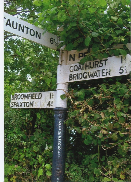
Image: © J Dowding Taken: Unknown
Pyramid finial - 4 arms; Somerset SCC pyramid by the UC road, in parish of Broomfield (Sedgemoor District), on the north side of the T junction of Rookscastle Road and Shelthorn Hill. surveyed Milestone Society National ID: SO_ST2332
Images are licensed for reuse under creativecommons.org/licenses/by-sa/2.0
Image Location


Leaflet Map data © OpenStreetMap
Latitude
51.088459
Longitude
-3.088484