Old Boundary Marker by the B6430, Garstang Road, Calder Bridge
Introduction
The photograph on this page of Old Boundary Marker by the B6430, Garstang Road, Calder Bridge by Milestone Society as part of the Geograph project.
The Geograph project started in 2005 with the aim of publishing, organising and preserving representative images for every square kilometre of Great Britain, Ireland and the Isle of Man.

There are currently over 7.5m images from over 14,400 individuals and you can help contribute to the project by visiting https://www.geograph.org.uk
Old Boundary Marker by the B6430, Garstang Road, Calder Bridge
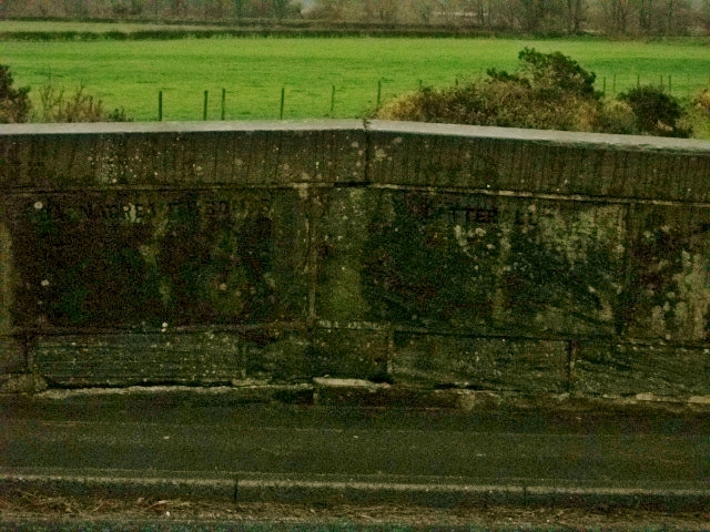
Image: © Milestone Society Taken: Unknown
Parish Boundary Marker by the B6430, in parish of Barnacre with Bonds (Wyre District), Garstang Road, Calder Bridge, legend in bridge, East side of road. The bridge is dated 1812. Inscription reads:- BARNAKER WITH BONDS | CATTERALL Calder Bridge is Grade II listed. List Entry Number: 1072932 https://historicengland.org.uk/listing/the-list/list-entry/1072932 Surveyed Milestone Society National ID: LA_PSGS08apb
Images are licensed for reuse under creativecommons.org/licenses/by-sa/2.0
Image Location
Latitude
53.88353
Longitude
-2.763468