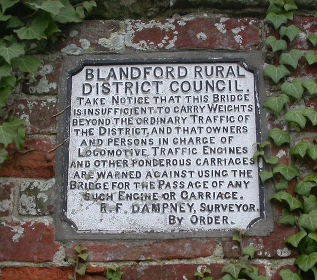
Old Bridge Marker by Ranston Bridge, Iwerne Courtney parish
Introduction
The photograph on this page of Old Bridge Marker by Ranston Bridge, Iwerne Courtney parish by Milestone Society as part of the Geograph project.
The Geograph project started in 2005 with the aim of publishing, organising and preserving representative images for every square kilometre of Great Britain, Ireland and the Isle of Man.
There are currently over 7.5m images from over 14,400 individuals and you can help contribute to the project by visiting https://www.geograph.org.uk

Image: © Milestone Society Taken: Unknown
Bridge Weight Plate by the UC road, in parish of Iwerne Courtney or Shroton (North Dorset District), Main Street, Ranston, inset into estate wall, South side of road; bridge invisible, river presumably culverted. Inscription reads:- BLANDFORD RURAL DISTRICT COUNCIL. TAKE NOTICE THAT THIS BRIDGE IS INSUFFICIENT TO CARRY WEIGHTS BEYOND THE ORDINARY TRAFFIC OF THE DISTRICT, AND THAT OWNERS AND PERSONS IN CHARGE OF LOCOMOTIVE TRAFFIC ENGINES AND OTHER PONDEROUS CARRIAGES ARE WARNED AGAINST USING THE BRIDGE FOR THE PASSAGE OF ANY SUCH ENGINE OR CARRIAGE. R. F. DAMPNEY, SURVEYOR. BY ORDER. Surveyed Milestone Society National ID: DO_WEIIWCbr

