Public footpath
Introduction
The photograph on this page of Public footpath by Alan Walker as part of the Geograph project.
The Geograph project started in 2005 with the aim of publishing, organising and preserving representative images for every square kilometre of Great Britain, Ireland and the Isle of Man.

There are currently over 7.5m images from over 14,400 individuals and you can help contribute to the project by visiting https://www.geograph.org.uk
Public footpath
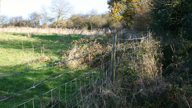
Image: © Alan Walker Taken: 6 Nov 2007
This north-easterly facing photograph shows a field where the footpath has been marginalized by the introduction of a barbed wire fence. The result is a badly maintained, difficult to negotiate footpath, where the walker has not only to negotiate nettles and briers but also the barbs on the wire because they come perilously close at times. Walkers who are not as sure footed as they once were or families with children would do well to look carefully at this shameful route first before negotiating it. For a more north-easterly (ahead) photograph of the footpath, click here Image For a more south-westerly (behind the viewpoint) photograph of the footpath, click here Image
Images are licensed for reuse under creativecommons.org/licenses/by-sa/2.0
Image Location


Leaflet Map data © OpenStreetMap
Latitude
53.1689
Longitude
-1.364505