Frogshole Farm public house
Introduction
The photograph on this page of Frogshole Farm public house by Andy Potter as part of the Geograph project.
The Geograph project started in 2005 with the aim of publishing, organising and preserving representative images for every square kilometre of Great Britain, Ireland and the Isle of Man.

There are currently over 7.5m images from over 14,400 individuals and you can help contribute to the project by visiting https://www.geograph.org.uk
Frogshole Farm public house
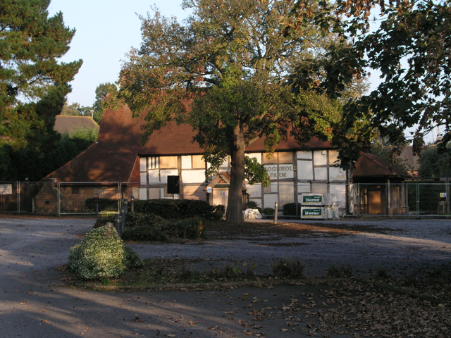
Image: © Andy Potter Taken: 14 Oct 2007
Still boarded up from the fire in February (2007) but the enclosing fences now display planning applications (so things are looking up). The pub's name is not a contrivance of Olde Worlde corporate branding as this actually was the farmhouse for Frogshole Farm. The timber-framed building dates from the 16th century with numerous modifications over the centuries (and probably a few fires too!) Most of surrounding development is built on the fields of the old farm so Maidenbower could well have been named Frogshole instead.
Images are licensed for reuse under creativecommons.org/licenses/by-sa/2.0
Image Location


Leaflet Map data © OpenStreetMap
Latitude
51.108631
Longitude
-0.148656