RAF Hurn - former WW2 airfield technical site (3)
Introduction
The photograph on this page of RAF Hurn - former WW2 airfield technical site (3) by Mike Searle as part of the Geograph project.
The Geograph project started in 2005 with the aim of publishing, organising and preserving representative images for every square kilometre of Great Britain, Ireland and the Isle of Man.

There are currently over 7.5m images from over 14,400 individuals and you can help contribute to the project by visiting https://www.geograph.org.uk
RAF Hurn - former WW2 airfield technical site (3)
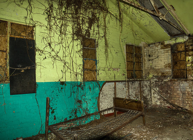
Image: © Mike Searle Taken: 11 Feb 2019
- Flight Offices & Crew Room Interior view of an office within the 'T' shaped Flight Office building. Image
Images are licensed for reuse under creativecommons.org/licenses/by-sa/2.0
Image Location
Latitude
50.787572
Longitude
-1.833545