RAF Hurn - former WW2 airfield technical site (1)
Introduction
The photograph on this page of RAF Hurn - former WW2 airfield technical site (1) by Mike Searle as part of the Geograph project.
The Geograph project started in 2005 with the aim of publishing, organising and preserving representative images for every square kilometre of Great Britain, Ireland and the Isle of Man.

There are currently over 7.5m images from over 14,400 individuals and you can help contribute to the project by visiting https://www.geograph.org.uk
RAF Hurn - former WW2 airfield technical site (1)
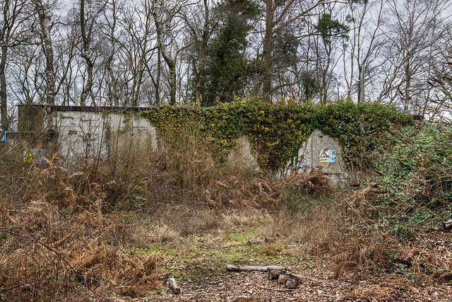
Image: © Mike Searle Taken: 11 Feb 2019
- Sleeping Shelter In a clearing in woodland just north of the main airport industrial area are the remains of a technical site, one of several that would have served the needs of the wartime airfield. Despite the state of total dereliction, boarded up and in poor condition, the buildings are nevertheless, still recognisable as wartime structures that are probably the last to have survived unaltered (some wartime structures are known to have since been incorporated into some modern buildings). A brief history. RAF Station Hurn airfield was planned as a satellite to RAF Ibsley, opening in 1941. It was home to a number of RAF fighter interceptor squadrons until 1944 when it was then given over to the USAAF transport command. By October 1944 it was returned briefly to the RAF before being passed into the care of the Ministry of Civil Aviation. Taking on its civil role, Hurn remained the UK's main international terminal until the opening of Heathrow in 1949. Since then Hurn has remained in use by a number of aviation operators and builders, and its modern role continues as Bournemouth International Airport. Image
Images are licensed for reuse under creativecommons.org/licenses/by-sa/2.0
Image Location
Latitude
50.787842
Longitude
-1.833686