
Ecclefechan
Introduction
The photograph on this page of Ecclefechan by James Johnstone as part of the Geograph project.
The Geograph project started in 2005 with the aim of publishing, organising and preserving representative images for every square kilometre of Great Britain, Ireland and the Isle of Man.

There are currently over 7.5m images from over 14,400 individuals and you can help contribute to the project by visiting https://www.geograph.org.uk
Ecclefechan
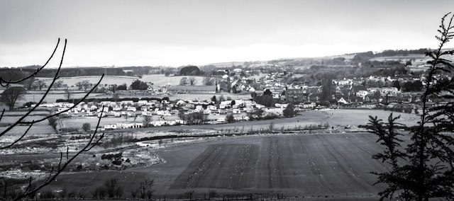
Image: © James Johnstone Taken: 13 Feb 2016
Ecclefechan is a small village in the south of Scotland in Dumfries and Galloway.. The name Ecclefechan is derived from the Brythonic for "small church" (cognate with Welsh eglwys meaning church and bychan meaning small, which has the form fechan following a feminine noun). After Gaelic later spread in the area, the belief arose that the name derived from the 7th century St Féchín of Fore. A suggestion that Ecclefechan lay within the early middle age kingdom of Rheged is based on an outdated and now widely rejected idea that Rheged comprised the lands of Cumbria and Dumfries and Galloway and also presumes that Ecclefechan existed as a settlement in those times (c.500-600s). The location of Rheged remains a mystery.. . The village is known as "Fechan" to the local residents. https://flic.kr/p/246V1Cc
Images are licensed for reuse under creativecommons.org/licenses/by-sa/2.0
Image Location

Latitude
55.057113
Longitude
-3.259094