The Penparcau Milestone
Introduction
The photograph on this page of The Penparcau Milestone by Richard Law as part of the Geograph project.
The Geograph project started in 2005 with the aim of publishing, organising and preserving representative images for every square kilometre of Great Britain, Ireland and the Isle of Man.

There are currently over 7.5m images from over 14,400 individuals and you can help contribute to the project by visiting https://www.geograph.org.uk
The Penparcau Milestone
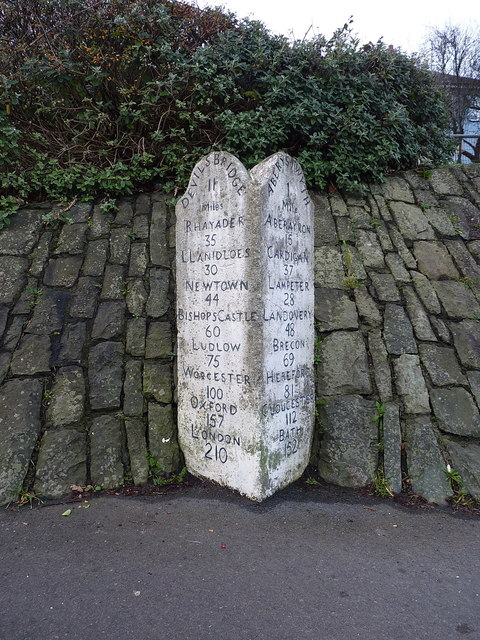
Image: © Richard Law Taken: 26 Dec 2018
Dating from the 19th century turnpike road, and Grade II listed https://britishlistedbuildings.co.uk/300010419-milestone-aberystwyth in 1987. There are two others of similar style in the town, being Image and Image respectively.
Images are licensed for reuse under creativecommons.org/licenses/by-sa/2.0
Image Location
Latitude
52.402103
Longitude
-4.074187