Old Direction Sign - Signpost by the A356, Turnpike Cross, Misterton
Introduction
The photograph on this page of Old Direction Sign - Signpost by the A356, Turnpike Cross, Misterton by Milestone Society as part of the Geograph project.
The Geograph project started in 2005 with the aim of publishing, organising and preserving representative images for every square kilometre of Great Britain, Ireland and the Isle of Man.

There are currently over 7.5m images from over 14,400 individuals and you can help contribute to the project by visiting https://www.geograph.org.uk
Old Direction Sign - Signpost by the A356, Turnpike Cross, Misterton
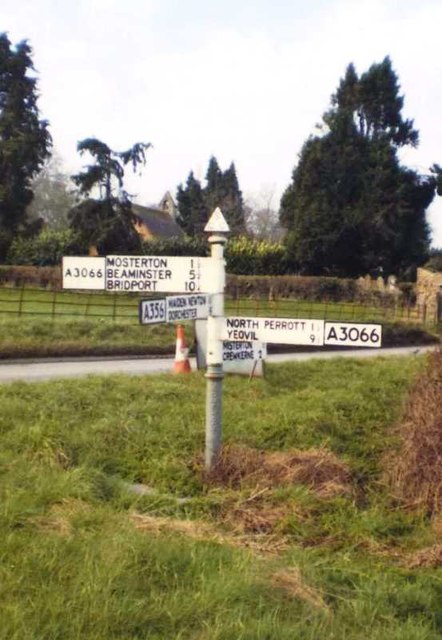
Image: © Milestone Society Taken: Unknown
Pyramid finial - 4 arms; Somerset pointing fingers by the A356, in parish of Misterton (South Somerset District), Turnpike Cross crossroads with the A3066. Surveyed Milestone Society National ID: SO_ST4607
Images are licensed for reuse under creativecommons.org/licenses/by-sa/2.0
Image Location
Latitude
50.868417
Longitude
-2.76771