Old Milestone by the A491, Hagley Road, Old Swinford, Stourbridge
Introduction
The photograph on this page of Old Milestone by the A491, Hagley Road, Old Swinford, Stourbridge by M Faherty as part of the Geograph project.
The Geograph project started in 2005 with the aim of publishing, organising and preserving representative images for every square kilometre of Great Britain, Ireland and the Isle of Man.

There are currently over 7.5m images from over 14,400 individuals and you can help contribute to the project by visiting https://www.geograph.org.uk
Old Milestone by the A491, Hagley Road, Old Swinford, Stourbridge
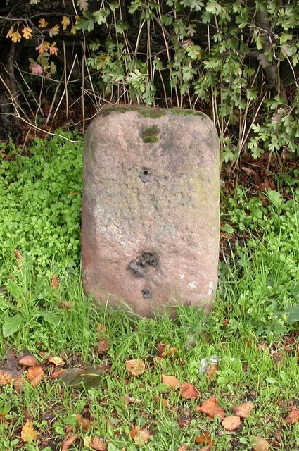
Image: © M Faherty Taken: 12 Oct 2006
Stone post (plate lost) by the A491, in parish of STOURBRIDGE (DUDLEY District), Hagley Road; Old Swinford; opposite junction with the B4187, by the road, on East side of road. Stourbridge plate, erected by the Stourbridge turnpike trust in the 19th century. Inscription once read:- (STOUR=E) (1) (MILES) (9) (BROMS=E) Dudley HER. HER Number: 12537 https://www.heritagegateway.org.uk/Gateway/Results_Single.aspx?uid=MDD2464&resourceID=1038 Milestone Society National ID: WO_STBR01.
Images are licensed for reuse under creativecommons.org/licenses/by-sa/2.0
Image Location


Leaflet Map data © OpenStreetMap
Latitude
52.444496
Longitude
-2.138722