Old Milestone by the B846, Glengoulandie, Dull parish
Introduction
The photograph on this page of Old Milestone by the B846, Glengoulandie, Dull parish by Milestone Society as part of the Geograph project.
The Geograph project started in 2005 with the aim of publishing, organising and preserving representative images for every square kilometre of Great Britain, Ireland and the Isle of Man.

There are currently over 7.5m images from over 14,400 individuals and you can help contribute to the project by visiting https://www.geograph.org.uk
Old Milestone by the B846, Glengoulandie, Dull parish
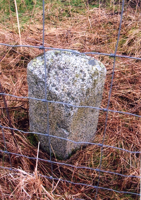
Image: © Milestone Society Taken: Unknown
Stone post by the B846, in parish of Dull (District), Glengoulandie, behind wire fence. Inscription once read:- : (TUMMEL BRIDGE 5½) : : (ABERFELDY 8) : Surveyed Milestone Society National ID: PK_AFTB08
Images are licensed for reuse under creativecommons.org/licenses/by-sa/2.0
Image Location
Latitude
56.650302
Longitude
-4.009819