Old Milestone by the A232, Cheam Road, Sutton and Cheam parish
Introduction
The photograph on this page of Old Milestone by the A232, Cheam Road, Sutton and Cheam parish by JS Payne as part of the Geograph project.
The Geograph project started in 2005 with the aim of publishing, organising and preserving representative images for every square kilometre of Great Britain, Ireland and the Isle of Man.

There are currently over 7.5m images from over 14,400 individuals and you can help contribute to the project by visiting https://www.geograph.org.uk
Old Milestone by the A232, Cheam Road, Sutton and Cheam parish
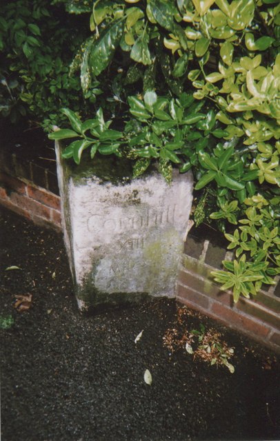
Image: © JS Payne Taken: 1 Oct 2010
Carved stone post by the A232, in parish of SUTTON AND CHEAM (SUTTON District), Cheam Road, by No. 135, opposite Carlisle Road, back to boundary wall, set in pavement, on South side of road. Cheam stone, erected by the Reigate turnpike trust in the 19th century. Inscription reads:- : WESTMINSTER / BRIDGE / XII / MILES : : 1755 : : CORNHILL / XIII / MILES : Carved benchmark and rivet on top. Scheduled Monument. List Entry Number: 1001999 https://historicengland.org.uk/listing/the-list/list-entry/1001999 Milestone Society National ID: SY_LQRA12.
Images are licensed for reuse under creativecommons.org/licenses/by-sa/2.0
Image Location
Latitude
51.35967
Longitude
-0.207239