Old Milestone by the A487, Blaenporth, Aberporth parish
Introduction
The photograph on this page of Old Milestone by the A487, Blaenporth, Aberporth parish by Milestone Society as part of the Geograph project.
The Geograph project started in 2005 with the aim of publishing, organising and preserving representative images for every square kilometre of Great Britain, Ireland and the Isle of Man.

There are currently over 7.5m images from over 14,400 individuals and you can help contribute to the project by visiting https://www.geograph.org.uk
Old Milestone by the A487, Blaenporth, Aberporth parish
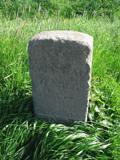
Image: © Milestone Society Taken: Unknown
Cardigan low profile top by the A487, in parish of Aberporth (Ceredigion District), East of Blaenporth, on verge, South side of road. Inscription reads:- TO CARDIGAN 6 MILES Grade II listed by Cadw. Reference Number: 16085 https://cadwpublic-api.azurewebsites.net/reports/listedbuilding/FullReport?lang=&id=16085 Surveyed Milestone Society National ID: CRD_CAAY06
Images are licensed for reuse under creativecommons.org/licenses/by-sa/2.0
Image Location
Latitude
52.109566
Longitude
-4.535273