Old Milestone by the A696, south of Liberty Hill, Elsdon parish
Introduction
The photograph on this page of Old Milestone by the A696, south of Liberty Hill, Elsdon parish by IA Davison as part of the Geograph project.
The Geograph project started in 2005 with the aim of publishing, organising and preserving representative images for every square kilometre of Great Britain, Ireland and the Isle of Man.

There are currently over 7.5m images from over 14,400 individuals and you can help contribute to the project by visiting https://www.geograph.org.uk
Old Milestone by the A696, south of Liberty Hill, Elsdon parish
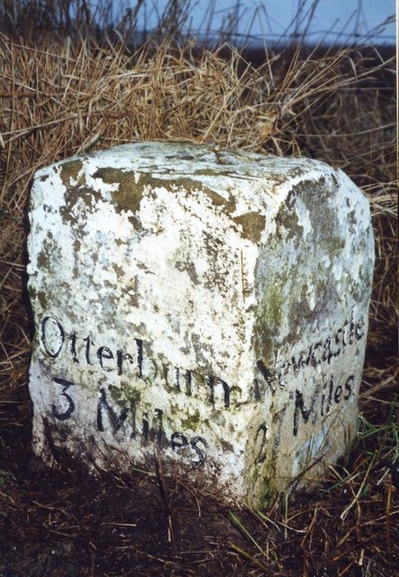
Image: © IA Davison Taken: 1 Jan 2002
Carved stone post by the A696, in parish of ELSDON (ALNWICK District), South of Liberty Hill, on grass verge, on West side of road. Newcastle quadrant stone, erected by the Elsdon & Rudwater turnpike trust in the 19th century. Inscription reads:- : Otterburn / 3 Miles / (Jedbro / 29 Miles) : : Newcastle / 27 Miles : Carved benchmark and rivet on top. Northumberland HER. Reference number: N16798 https://www.heritagegateway.org.uk/Gateway/Results_Single.aspx?uid=N16798&resourceID=110 Milestone Society National ID: NB_NCJB27.
Images are licensed for reuse under creativecommons.org/licenses/by-sa/2.0
Image Location
Latitude
55.212643
Longitude
-2.110403