Old Milestone by the A429, Northleach with Eastington parish
Introduction
The photograph on this page of Old Milestone by the A429, Northleach with Eastington parish by J Stanbridge as part of the Geograph project.
The Geograph project started in 2005 with the aim of publishing, organising and preserving representative images for every square kilometre of Great Britain, Ireland and the Isle of Man.

There are currently over 7.5m images from over 14,400 individuals and you can help contribute to the project by visiting https://www.geograph.org.uk
Old Milestone by the A429, Northleach with Eastington parish
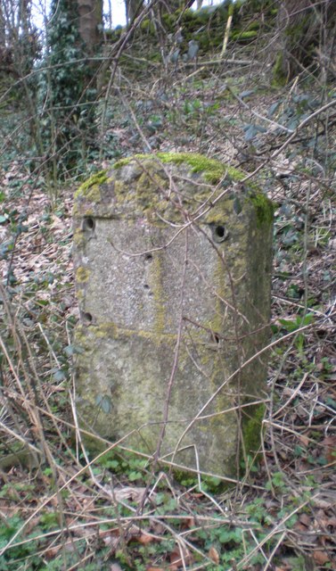
Image: © J Stanbridge Taken: 2 Nov 2009
Stone post (plate lost) by the A429, in parish of NORTHLEACH WITH EASTINGTON (COTSWOLD District), North of Farmington turn, on the verge well hidden by vegetation, on East side of road. Stow iron plate, erected by the Foss & Cross (Stow on the Wold) turnpike trust in the 19th century. Inscription once read:- (STOW 8) (CIREN R 11) (BATH 44) Grade II listed. List Entry Number: 1089860 https://historicengland.org.uk/listing/the-list/list-entry/1089860 Milestone Society National ID: GL_CISW11.
Images are licensed for reuse under creativecommons.org/licenses/by-sa/2.0
Image Location
Latitude
51.841923
Longitude
-1.830505