Old Direction Sign - Signpost near Hungryhatton, Childs Ercall parish
Introduction
The photograph on this page of Old Direction Sign - Signpost near Hungryhatton, Childs Ercall parish by Milestone Society as part of the Geograph project.
The Geograph project started in 2005 with the aim of publishing, organising and preserving representative images for every square kilometre of Great Britain, Ireland and the Isle of Man.

There are currently over 7.5m images from over 14,400 individuals and you can help contribute to the project by visiting https://www.geograph.org.uk
Old Direction Sign - Signpost near Hungryhatton, Childs Ercall parish
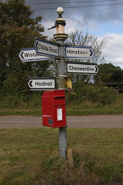
Image: © Milestone Society Taken: Unknown
Pawn finial - 4 Worboys arms; Shropshire CC ball by the UC road, in parish of Childs Ercall (North Shropshire District), South of Hungryhatton on large grass triangle. Surveyed Milestone Society National ID: SA_SJ6726
Images are licensed for reuse under creativecommons.org/licenses/by-sa/2.0
Image Location
Latitude
52.837921
Longitude
-2.484703