Old Boundary Marker south of Beals Mill Bridge, Stokeclimsland parish
Introduction
The photograph on this page of Old Boundary Marker south of Beals Mill Bridge, Stokeclimsland parish by Milestone Society as part of the Geograph project.
The Geograph project started in 2005 with the aim of publishing, organising and preserving representative images for every square kilometre of Great Britain, Ireland and the Isle of Man.

There are currently over 7.5m images from over 14,400 individuals and you can help contribute to the project by visiting https://www.geograph.org.uk
Old Boundary Marker south of Beals Mill Bridge, Stokeclimsland parish
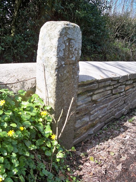
Image: © Milestone Society Taken: Unknown
Turnpike Terminus Marker by the UC road, in parish of Stokeclimsland (North Cornwall District), Beals Mill Bridge, against stone wall. Grade II listed. List Entry Number: 1220308 https://historicengland.org.uk/listing/the-list/list-entry/1220308 Surveyed Milestone Society National ID: CW_CLBM05t
Images are licensed for reuse under creativecommons.org/licenses/by-sa/2.0
Image Location


Leaflet Map data © OpenStreetMap
Latitude
50.569124
Longitude
-4.318835