Old Bridge Marker by Clifford Street, Chudleigh parish
Introduction
The photograph on this page of Old Bridge Marker by Clifford Street, Chudleigh parish by Alan Rosevear as part of the Geograph project.
The Geograph project started in 2005 with the aim of publishing, organising and preserving representative images for every square kilometre of Great Britain, Ireland and the Isle of Man.

There are currently over 7.5m images from over 14,400 individuals and you can help contribute to the project by visiting https://www.geograph.org.uk
Old Bridge Marker by Clifford Street, Chudleigh parish
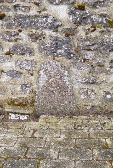
Image: © Alan Rosevear Taken: 8 Apr 2013
Bridge Marker by the UC road, in parish of Chudleigh (Teignbridge District), set in a stone wall by a sunken water hydrant on the southwest side of Clofford Street 80 metres northwest of Bridgeland Bridge, Kate Brook. Surveyed Milestone Society National ID: DV_CHAC01Bbr
Images are licensed for reuse under creativecommons.org/licenses/by-sa/2.0
Image Location
Latitude
50.603019
Longitude
-3.597698