Old Direction Sign - Signpost by the A378, Churchway, Curry Rivel parish
Introduction
The photograph on this page of Old Direction Sign - Signpost by the A378, Churchway, Curry Rivel parish by Alan Rosevear as part of the Geograph project.
The Geograph project started in 2005 with the aim of publishing, organising and preserving representative images for every square kilometre of Great Britain, Ireland and the Isle of Man.

There are currently over 7.5m images from over 14,400 individuals and you can help contribute to the project by visiting https://www.geograph.org.uk
Old Direction Sign - Signpost by the A378, Churchway, Curry Rivel parish
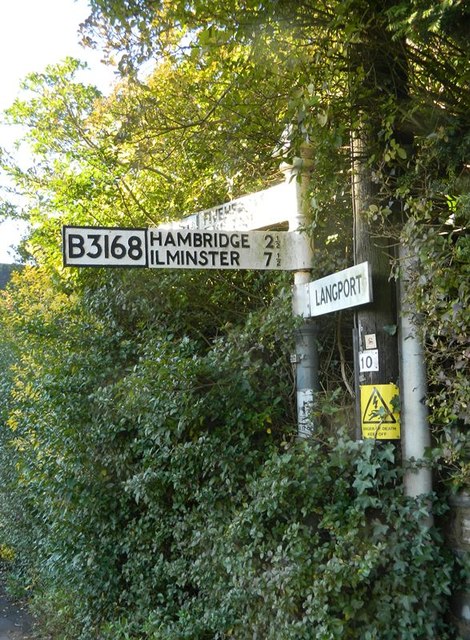
Image: © Alan Rosevear Taken: 21 Nov 2012
Pyramid finial - 3 arms; Somerset SCC pyramid by the A378, in parish of Curry Rivel (South Somerset District), centre of village, near junction with the B3168, beside the war memorial. Surveyed Milestone Society National ID: SO_ST3925
Images are licensed for reuse under creativecommons.org/licenses/by-sa/2.0
Image Location
Latitude
51.022915
Longitude
-2.868099