Old Direction Sign - Signpost by the B2111, Walstead, Lindfield Rural parish
Introduction
The photograph on this page of Old Direction Sign - Signpost by the B2111, Walstead, Lindfield Rural parish by Milestone Society as part of the Geograph project.
The Geograph project started in 2005 with the aim of publishing, organising and preserving representative images for every square kilometre of Great Britain, Ireland and the Isle of Man.

There are currently over 7.5m images from over 14,400 individuals and you can help contribute to the project by visiting https://www.geograph.org.uk
Old Direction Sign - Signpost by the B2111, Walstead, Lindfield Rural parish
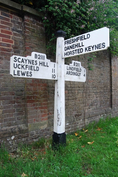
Image: © Milestone Society Taken: Unknown
Black iron cap finial - 3 arms; East Sussex wood with number by the B2111, in parish of Lindfield Rural (Mid Sussex District), opposite junction with East Mascalls Lane, on verge, against brick boundary wall of Walstead Place Care Home. Surveyed Milestone Society National ID: SX_TQ3524B
Images are licensed for reuse under creativecommons.org/licenses/by-sa/2.0
Image Location
Latitude
51.003362
Longitude
-0.067899