Old Boundary Marker by Water Hill Lane, Halifax parish
Introduction
The photograph on this page of Old Boundary Marker by Water Hill Lane, Halifax parish by Milestone Society as part of the Geograph project.
The Geograph project started in 2005 with the aim of publishing, organising and preserving representative images for every square kilometre of Great Britain, Ireland and the Isle of Man.

There are currently over 7.5m images from over 14,400 individuals and you can help contribute to the project by visiting https://www.geograph.org.uk
Old Boundary Marker by Water Hill Lane, Halifax parish
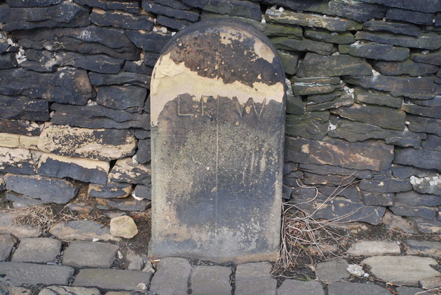
Image: © Milestone Society Taken: Unknown
Parish Boundary Marker by the UC road, in parish of Halifax (Calderdale District), Friendly, junction of Water Hill Lane with Blackwall Lane, on inside of bend between road and stone wall. Opposite Boundary Marker: YW_SOWB02pb Image Inscription reads:- LF | W (Luddenden Foot and Warley) Surveyed Milestone Society National ID: YW_SOWB01pb
Images are licensed for reuse under creativecommons.org/licenses/by-sa/2.0
Image Location
Latitude
53.715655
Longitude
-1.918717