Old Boundary Marker by the A6, Stockport Road, Longsight, Manchester
Introduction
The photograph on this page of Old Boundary Marker by the A6, Stockport Road, Longsight, Manchester by M Faherty as part of the Geograph project.
The Geograph project started in 2005 with the aim of publishing, organising and preserving representative images for every square kilometre of Great Britain, Ireland and the Isle of Man.

There are currently over 7.5m images from over 14,400 individuals and you can help contribute to the project by visiting https://www.geograph.org.uk
Old Boundary Marker by the A6, Stockport Road, Longsight, Manchester
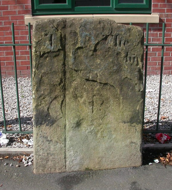
Image: © M Faherty Taken: 15 Jul 2007
Parish Boundary Marker on the west side of the A6 Stockport Road, Longsight, against the railings of the Plymouth Point development, opposite Newton Avenue. On the boundary of Moss Side and Rusholme townships. Both were parishes after 1866. Formerly recorded as milestone LA_BAPIC01 but shown as a boundary stone on old Ordnance Survey maps. See also https://images.manchester.gov.uk/collections/415e4c2e-8635-3d94-ad48-410959bc8510/?s%3D%26filter%5Bsubject.summary.title.keyword%5D%5B%5D%3DBoddan%2BPlace&pos=3 and http://www.flickr.com/photos/48274996@N08/5258726224/. Milestone Society National ID: LA_MANC03pb
Images are licensed for reuse under creativecommons.org/licenses/by-sa/2.0
Image Location
Latitude
53.459351
Longitude
-2.203703