Old Boundary Marker on Preston New Road
Introduction
The photograph on this page of Old Boundary Marker on Preston New Road by Milestone Society as part of the Geograph project.
The Geograph project started in 2005 with the aim of publishing, organising and preserving representative images for every square kilometre of Great Britain, Ireland and the Isle of Man.

There are currently over 7.5m images from over 14,400 individuals and you can help contribute to the project by visiting https://www.geograph.org.uk
Old Boundary Marker on Preston New Road
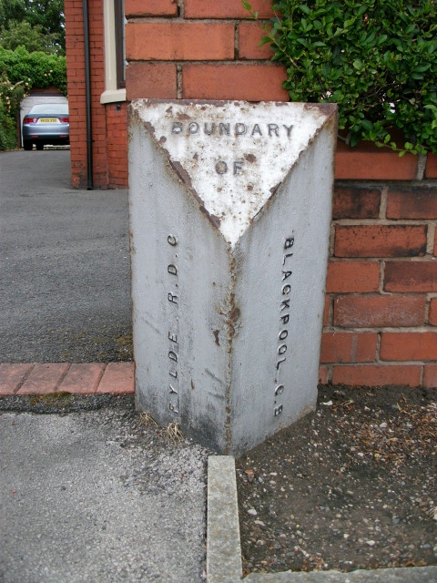
Image: © Milestone Society Taken: 8 Jun 2012
Parish Boundary Marker by the A583, in parish of Blackpool (Fylde District), on the north side of the eastern carriageway of Preston New Road, outside No 53 and opposite the junction with Joyce Avenue. surveyed Milestone Society National ID: LA_BPPS02pb
Images are licensed for reuse under creativecommons.org/licenses/by-sa/2.0
Image Location
Latitude
53.804532
Longitude
-3.021933