Old Guide Stone by the A3071, Higher Tregerest, Sancreed parish
Introduction
The photograph on this page of Old Guide Stone by the A3071, Higher Tregerest, Sancreed parish by Milestone Society as part of the Geograph project.
The Geograph project started in 2005 with the aim of publishing, organising and preserving representative images for every square kilometre of Great Britain, Ireland and the Isle of Man.

There are currently over 7.5m images from over 14,400 individuals and you can help contribute to the project by visiting https://www.geograph.org.uk
Old Guide Stone by the A3071, Higher Tregerest, Sancreed parish
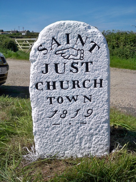
Image: © Milestone Society Taken: Unknown
Stone fingerpost by the A3071, in parish of Sancreed (Penwith District), Higher Tregerest, Y-junction with green road to the Beacon, by the road. For North face see: Image Inscription reads:- : SAINT / {<-hand} / JUST / CHURCH / TOWN / 1819 / - . - : : SAINT / {hand->} / JUST / NORTH / ROAD / and / MORVAH : Grade II listed. List Entry Number: 1158218 https://historicengland.org.uk/listing/the-list/list-entry/1158218 Surveyed Milestone Society National ID: CW_XSTJC
Images are licensed for reuse under creativecommons.org/licenses/by-sa/2.0
Image Location
Latitude
50.129766
Longitude
-5.628262