Old Milestone by the A449, Mosspit, Stafford parish
Introduction
The photograph on this page of Old Milestone by the A449, Mosspit, Stafford parish by Milestone Society as part of the Geograph project.
The Geograph project started in 2005 with the aim of publishing, organising and preserving representative images for every square kilometre of Great Britain, Ireland and the Isle of Man.

There are currently over 7.5m images from over 14,400 individuals and you can help contribute to the project by visiting https://www.geograph.org.uk
Old Milestone by the A449, Mosspit, Stafford parish
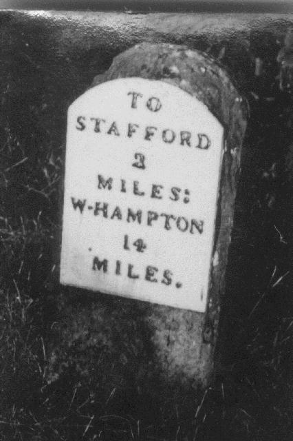
Image: © Milestone Society Taken: Unknown
Wolverhampton iron plate by the A449, Mosspit in parish of Stafford (Stafford District), East side of road, has been missing for many years. Lost since 1940. Inscription reads:- TO STAFFORD 2 MILES. W-HAMPTON 14 MILES. Milestone Society National ID: ST_WVST14
Images are licensed for reuse under creativecommons.org/licenses/by-sa/2.0
Image Location
Latitude
52.780793
Longitude
-2.114217