Old Boundary Marker on Wembdon Road
Introduction
The photograph on this page of Old Boundary Marker on Wembdon Road by A Rosevear as part of the Geograph project.
The Geograph project started in 2005 with the aim of publishing, organising and preserving representative images for every square kilometre of Great Britain, Ireland and the Isle of Man.

There are currently over 7.5m images from over 14,400 individuals and you can help contribute to the project by visiting https://www.geograph.org.uk
Old Boundary Marker on Wembdon Road
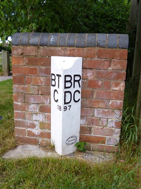
Image: © A Rosevear Taken: 24 Jun 2013
Parish Boundary Marker by the UC road, on the boundary of Bridgwater and Wembdon parishes (Sedgemoor District), on the southwest side of Wembdon Road, now a cul-de-sac on the southeast side of the A39 Homberg Way. On the boundary of Bridgwater parish, Bridgwater Town (Borough) Council and Wembdon parish, Bridgwater Rural District Council. Opposite Boundary Marker: SO_BGWE02pb Image Somerset HER. HER number: 26720 https://www.heritagegateway.org.uk/Gateway/Results_Single.aspx?uid=26720&resourceID=100 Surveyed Milestone Society National ID: SO_BGWE01pb
Images are licensed for reuse under creativecommons.org/licenses/by-sa/2.0
Image Location
Latitude
51.129503
Longitude
-3.020395