Old Milestone by the B4058, Bristol Road, Winterbourne parish
Introduction
The photograph on this page of Old Milestone by the B4058, Bristol Road, Winterbourne parish by R Shackell as part of the Geograph project.
The Geograph project started in 2005 with the aim of publishing, organising and preserving representative images for every square kilometre of Great Britain, Ireland and the Isle of Man.

There are currently over 7.5m images from over 14,400 individuals and you can help contribute to the project by visiting https://www.geograph.org.uk
Old Milestone by the B4058, Bristol Road, Winterbourne parish
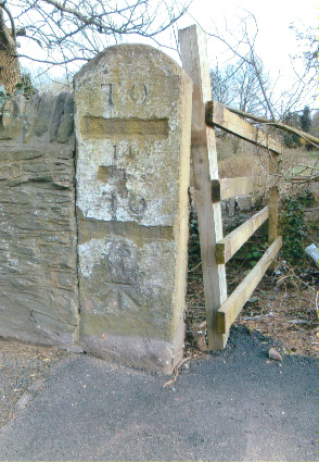
Image: © R Shackell Taken: Unknown
Carved stone post by the B4058, in parish of WINTERBOURNE (SOUTH GLOUCESTERSHIRE District), Bristol Road, Hambrook, just West of motorway, end of stone wall, next to gate, on South side of road. Erected by the Sodbury Division turnpike trust in the 19th century. Defaced inscription reads:- TO (BATH) 14 TO (BRISTOL) 5 Carved benchmark lower face. Milestone Society National ID: GL_BRWE05.
Images are licensed for reuse under creativecommons.org/licenses/by-sa/2.0
Image Location
Latitude
51.509
Longitude
-2.513807