Old Milepost by the B269, Selsdon and Sanderstead parish
Introduction
The photograph on this page of Old Milepost by the B269, Selsdon and Sanderstead parish by JS Payne as part of the Geograph project.
The Geograph project started in 2005 with the aim of publishing, organising and preserving representative images for every square kilometre of Great Britain, Ireland and the Isle of Man.

There are currently over 7.5m images from over 14,400 individuals and you can help contribute to the project by visiting https://www.geograph.org.uk
Old Milepost by the B269, Selsdon and Sanderstead parish
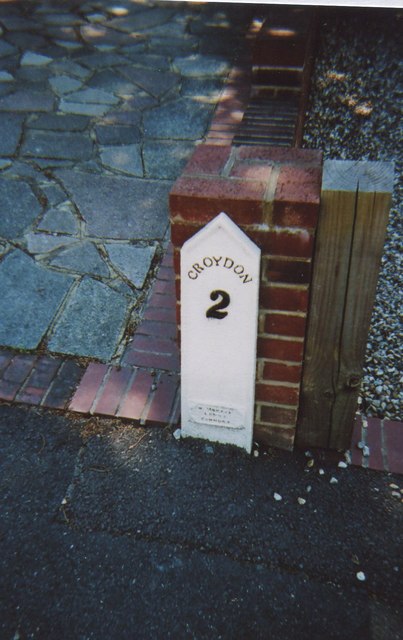
Image: © JS Payne Taken: 1 Oct 2007
Cast iron post by the B269, in parish of SELSDON AND SANDERSTEAD (CROYDON District), Sanderstead Hill, by No.36, half mile North of the junction with the A2022, back of pavement against brick gate pillar, on West side of road. Croydon gable iron plate, erected by the Limpsfield turnpike trust in the 19th century. Inscription reads:- CROYDON 2 (?) IRON FOUNDRY Milestone Society National ID: SY_CYLF02.
Images are licensed for reuse under creativecommons.org/licenses/by-sa/2.0
Image Location
Latitude
51.338847
Longitude
-0.083689