Old Milestone by the A432, Badminton Road, Old Sodbury
Introduction
The photograph on this page of Old Milestone by the A432, Badminton Road, Old Sodbury by R Wilson as part of the Geograph project.
The Geograph project started in 2005 with the aim of publishing, organising and preserving representative images for every square kilometre of Great Britain, Ireland and the Isle of Man.

There are currently over 7.5m images from over 14,400 individuals and you can help contribute to the project by visiting https://www.geograph.org.uk
Old Milestone by the A432, Badminton Road, Old Sodbury
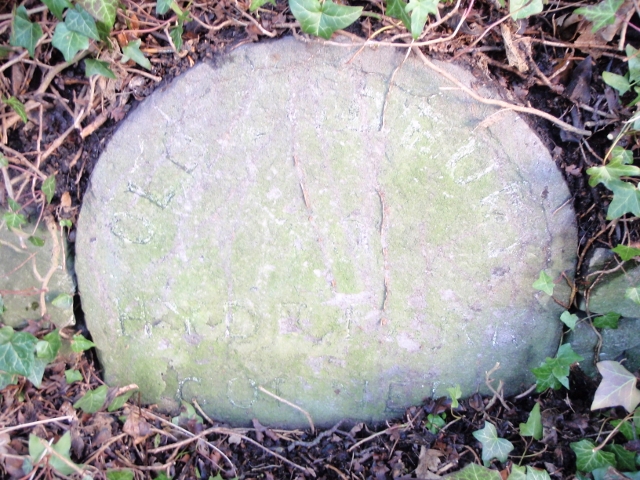
Image: © R Wilson Taken: 1 Jan 2013
Metal plate attached to stone post by the A432, in parish of SODBURY (SOUTH GLOUCESTERSHIRE District), Badminton Road, 30m East of junction with Hill Lane, in wall covered by ivy, on North side of road. Old Sodbury plate, erected by the Sodbury Division turnpike trust in the 19th century. Inscription reads:- OLD SODBURY HYDE PARK CORNER 106 MILES 14 MILES TO BRISTOL Grade II listed. List Entry Number: 1129240 https://historicengland.org.uk/listing/the-list/list-entry/1129240 Milestone Society National ID: GL_SYCP02.
Images are licensed for reuse under creativecommons.org/licenses/by-sa/2.0
Image Location
Latitude
51.530204
Longitude
-2.352603