Old Milepost by the A49, Wilton, Bridstow parish
Introduction
The photograph on this page of Old Milepost by the A49, Wilton, Bridstow parish by M Faherty as part of the Geograph project.
The Geograph project started in 2005 with the aim of publishing, organising and preserving representative images for every square kilometre of Great Britain, Ireland and the Isle of Man.

There are currently over 7.5m images from over 14,400 individuals and you can help contribute to the project by visiting https://www.geograph.org.uk
Old Milepost by the A49, Wilton, Bridstow parish
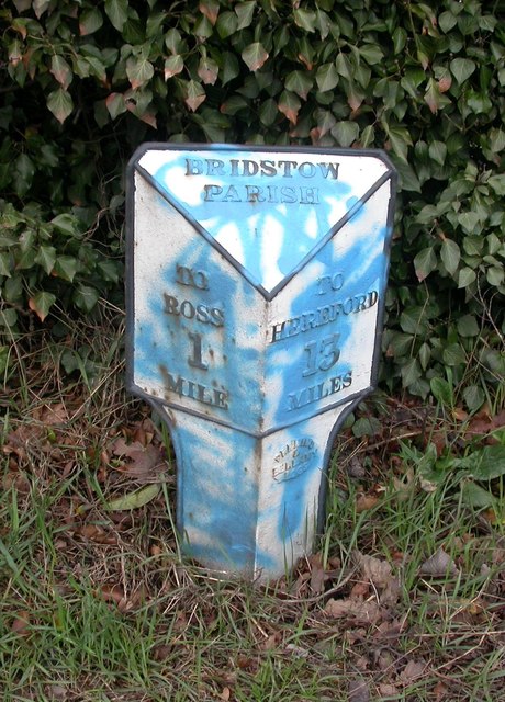
Image: © M Faherty Taken: 16 Mar 2008
Cast iron post by the A49, in parish of BRIDSTOW (District), Wilton; 80m North of junction with the A40, on the verge, on East side of road. Perkin Ross iron T-post, erected by the Ross turnpike trust in the 19th/20th century. Inscription reads:- : TO / ROSS / 1 / MILE : : BRIDSTOW / PARISH : : TO / HEREFORD / 13 / MILES : Maker:- : PERKINS / & / BELLAMY / ROSS. : Grade II listed. List Entry Number: 1214298 https://historicengland.org.uk/listing/the-list/list-entry/1214298 Milestone Society National ID: HF_HFRS13.
Images are licensed for reuse under creativecommons.org/licenses/by-sa/2.0
Image Location


Leaflet Map data © OpenStreetMap
Latitude
51.917233
Longitude
-2.60357