Old Boundary Marker by the B1026, Butt Road, Colchester parish
Introduction
The photograph on this page of Old Boundary Marker by the B1026, Butt Road, Colchester parish by Milestone Society as part of the Geograph project.
The Geograph project started in 2005 with the aim of publishing, organising and preserving representative images for every square kilometre of Great Britain, Ireland and the Isle of Man.

There are currently over 7.5m images from over 14,400 individuals and you can help contribute to the project by visiting https://www.geograph.org.uk
Old Boundary Marker by the B1026, Butt Road, Colchester parish
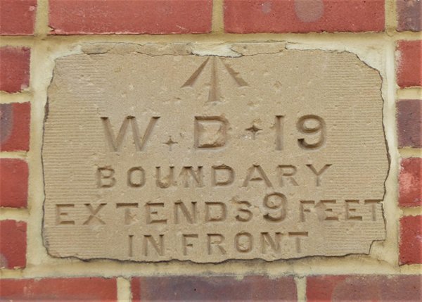
Image: © Milestone Society Taken: Unknown
Estate Boundary Marker - War Department by the B1026, in parish of Colchester (Colchester District), Butt Road, set high in brick wall of new development, Southeast side of road by zebra crossing. Inscription reads:- ^ W D 19 BOUNDARY EXTENDS 9 FEET IN FRONT Surveyed Milestone Society National ID: EX_COLC19em
Images are licensed for reuse under creativecommons.org/licenses/by-sa/2.0
Image Location
Latitude
51.884183
Longitude
0.893295