Old Milestone near Toomer Farm, Henstridge parish
Introduction
The photograph on this page of Old Milestone near Toomer Farm, Henstridge parish by JR Dowding as part of the Geograph project.
The Geograph project started in 2005 with the aim of publishing, organising and preserving representative images for every square kilometre of Great Britain, Ireland and the Isle of Man.

There are currently over 7.5m images from over 14,400 individuals and you can help contribute to the project by visiting https://www.geograph.org.uk
Old Milestone near Toomer Farm, Henstridge parish
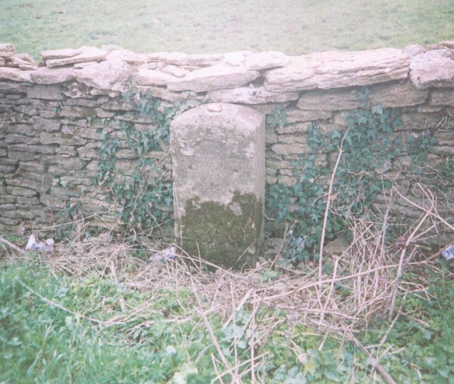
Image: © JR Dowding Taken: 1 Apr 2004
Stone post (plate lost) by the A30, in parish of HENSTRIDGE (SOUTH SOMERSET District), Southwest of Henstridge, near Toomer Farm, on the verge against wall, on South side of road. Sherbourne iron plate, erected by the Sherborne turnpike trust in the 18th century. Inscription once read:- (Sherborne) (5) (Shaftesbury) (11) Somerset HER. HER number: 19641 https://www.heritagegateway.org.uk/Gateway/Results_Single.aspx?uid=19641&resourceID=100 Milestone Society National ID: SO_SBBF05.
Images are licensed for reuse under creativecommons.org/licenses/by-sa/2.0
Image Location
Latitude
50.97146
Longitude
-2.42224