Old Milestone by the A20, London Road, Addington parish
Introduction
The photograph on this page of Old Milestone by the A20, London Road, Addington parish by C Woodward as part of the Geograph project.
The Geograph project started in 2005 with the aim of publishing, organising and preserving representative images for every square kilometre of Great Britain, Ireland and the Isle of Man.

There are currently over 7.5m images from over 14,400 individuals and you can help contribute to the project by visiting https://www.geograph.org.uk
Old Milestone by the A20, London Road, Addington parish
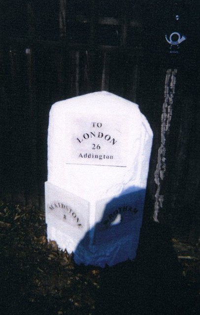
Image: © C Woodward Taken: 10 Jun 2009
Modern stone plaques attached to stone post by the A20, in parish of ADDINGTON (TONBRIDGE AND MALLING District), London Road, by "Sundown", near junction with Seven Mile Lane, back of verge beside wooden fence and gate, on North side of road. Kent hipped iron plate, erected by the Wrotham & Maidstone turnpike trust in the 19th century. Inscription reads:- : MAIDSTONE / 8 : : TO / LONDON / 26/ - / Addington : : WROTHAM / 2 : Kent HER. HER Number: TQ 65 NW 266 https://www.heritagegateway.org.uk/Gateway/Results_Single.aspx?uid=MKE78046&resourceID=1005 Milestone Society National ID: KE_LF26.
Images are licensed for reuse under creativecommons.org/licenses/by-sa/2.0
Image Location
Latitude
51.29814
Longitude
0.347735