Old Direction Sign - Signpost by the B3153, High Street, Keinton Mandeville parish
Introduction
The photograph on this page of Old Direction Sign - Signpost by the B3153, High Street, Keinton Mandeville parish by Milestone Society as part of the Geograph project.
The Geograph project started in 2005 with the aim of publishing, organising and preserving representative images for every square kilometre of Great Britain, Ireland and the Isle of Man.

There are currently over 7.5m images from over 14,400 individuals and you can help contribute to the project by visiting https://www.geograph.org.uk
Old Direction Sign - Signpost by the B3153, High Street, Keinton Mandeville parish
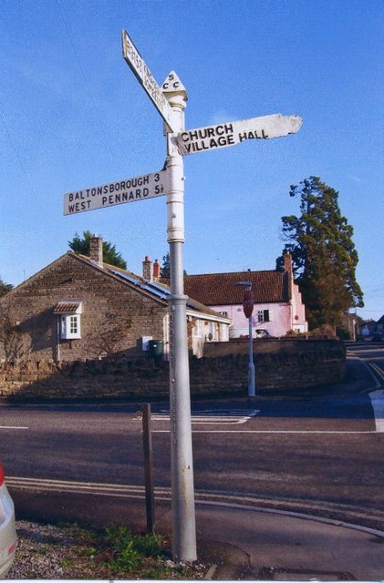
Image: © Milestone Society Taken: Unknown
Pyramid finial - 4 arms, 1 missing; Somerset SCC pyramid by the B3153, in parish of Keinton Mandeville (South Somerset District), High Street junction with Combe Hill. N.B. Adjacent building redeveloped and signpost apparently broken off and missing from Streetview April 2021. Surveyed Milestone Society National ID: SO_ST5430
Images are licensed for reuse under creativecommons.org/licenses/by-sa/2.0
Image Location


Leaflet Map data © OpenStreetMap
Latitude
51.07628
Longitude
-2.64526