Old Bridge Marker by Union Inn, Union Hill, Bude Stratton parish
Introduction
The photograph on this page of Old Bridge Marker by Union Inn, Union Hill, Bude Stratton parish by Milestone Society as part of the Geograph project.
The Geograph project started in 2005 with the aim of publishing, organising and preserving representative images for every square kilometre of Great Britain, Ireland and the Isle of Man.

There are currently over 7.5m images from over 14,400 individuals and you can help contribute to the project by visiting https://www.geograph.org.uk
Old Bridge Marker by Union Inn, Union Hill, Bude Stratton parish
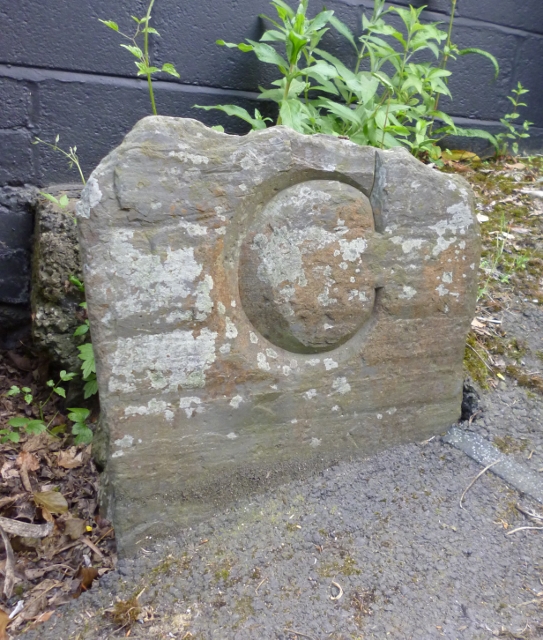
Image: © Milestone Society Taken: Unknown
Bridge Marker by the UC road, in parish of Bude Stratton (North Cornwall District), Town Bridge, River Strat, against Union House wall on Union Hill - formerly Union Inn. Surveyed Milestone Society National ID: CW_STRA01br
Images are licensed for reuse under creativecommons.org/licenses/by-sa/2.0
Image Location
Latitude
50.829264
Longitude
-4.516565