Old Guide Stone near Pengrugla, St Ewe parish
Introduction
The photograph on this page of Old Guide Stone near Pengrugla, St Ewe parish by Milestone Society as part of the Geograph project.
The Geograph project started in 2005 with the aim of publishing, organising and preserving representative images for every square kilometre of Great Britain, Ireland and the Isle of Man.

There are currently over 7.5m images from over 14,400 individuals and you can help contribute to the project by visiting https://www.geograph.org.uk
Old Guide Stone near Pengrugla, St Ewe parish
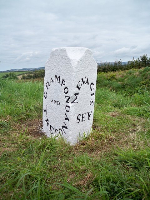
Image: © Milestone Society Taken: Unknown
Guidestone by the UC road, in parish of St Ewe (Restormel District), near Pengrugla, on apex of Y-junction, on the verge. Inscription reads:- : GRAMPOND / AND / TREGONY : : MEVAGIS / SEY : Grade II listed. List Entry Number: 1327047 https://historicengland.org.uk/listing/the-list/list-entry/1327047 Surveyed Milestone Society National ID: CW_XSTE3
Images are licensed for reuse under creativecommons.org/licenses/by-sa/2.0
Image Location
Latitude
50.290473
Longitude
-4.821015