Old Wayside Cross by the A167, Durham parish
Introduction
The photograph on this page of Old Wayside Cross by the A167, Durham parish by Milestone Society as part of the Geograph project.
The Geograph project started in 2005 with the aim of publishing, organising and preserving representative images for every square kilometre of Great Britain, Ireland and the Isle of Man.

There are currently over 7.5m images from over 14,400 individuals and you can help contribute to the project by visiting https://www.geograph.org.uk
Old Wayside Cross by the A167, Durham parish
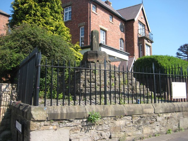
Image: © Milestone Society Taken: Unknown
Neville's Cross, old base and stump of shaft, by the A167, in parish of Durham (Durham District), Crossgate, junction with A690, marking site of battle of Neville's Cross in 1346. Grade II listed. List Entry Number: 1323226 https://historicengland.org.uk/listing/the-list/list-entry/1323226 Scheduled Monument. List Entry Number: 1016622 https://historicengland.org.uk/listing/the-list/list-entry/1016622 Surveyed Milestone Society National ID: DUDU_DUR02
Images are licensed for reuse under creativecommons.org/licenses/by-sa/2.0
Image Location
Latitude
54.772428
Longitude
-1.593358