Old Milestone by the B4363, south of Wall Town, Neen Savage parish
Introduction
The photograph on this page of Old Milestone by the B4363, south of Wall Town, Neen Savage parish by A Reade/M Faherty as part of the Geograph project.
The Geograph project started in 2005 with the aim of publishing, organising and preserving representative images for every square kilometre of Great Britain, Ireland and the Isle of Man.

There are currently over 7.5m images from over 14,400 individuals and you can help contribute to the project by visiting https://www.geograph.org.uk
Old Milestone by the B4363, south of Wall Town, Neen Savage parish
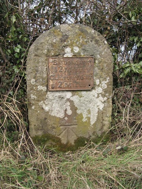
Image: © A Reade/M Faherty Taken: 8 Feb 2008
Metal plate attached to stone post by the B4363, in parish of NEEN SAVAGE (BRIDGNORTH District), Walltown; 250m South of Walltown Farm, on the verge against hedge, on West side of road. Cleobury iron plate, erected by the Cleobury Mortimer to Bridgnorth turnpike trust in the 19th century. Inscription reads:- BRIDGNORTH 12 MILES CLEOBURY MORTR 2 MILES Carved benchmark front lower middle. Shropshire HER. HER Number (PRN): 21119 https://www.heritagegateway.org.uk/Gateway/Results_Single.aspx?uid=MSA23692&resourceID=1015 Milestone Society National ID: SA_BNCM12.
Images are licensed for reuse under creativecommons.org/licenses/by-sa/2.0
Image Location
Latitude
52.398854
Longitude
-2.456198