Old Boundary Marker by the B3362, Culverhill, Lamerton parish
Introduction
The photograph on this page of Old Boundary Marker by the B3362, Culverhill, Lamerton parish by Milestone Society as part of the Geograph project.
The Geograph project started in 2005 with the aim of publishing, organising and preserving representative images for every square kilometre of Great Britain, Ireland and the Isle of Man.

There are currently over 7.5m images from over 14,400 individuals and you can help contribute to the project by visiting https://www.geograph.org.uk
Old Boundary Marker by the B3362, Culverhill, Lamerton parish
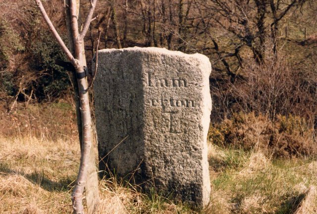
Image: © Milestone Society Taken: Unknown
Parish Boundary Marker by the B3362, in parish of Lamerton (West Devon District), near Culverhill. Lost Inscription reads:- : Syden / ham / Damer / ell : : Lam / erton : Milestone Society National ID: DV_SYLM01pb
Images are licensed for reuse under creativecommons.org/licenses/by-sa/2.0
Image Location
Latitude
50.569661
Longitude
-4.225454